Fidvár near Vráble - Archaeological Investigations at a Central Place of the Early Bronze Age on the Fringes of the Western Carpathians in Slovakia 2007-08
.")
Geographical setting
The Western Carpathians are characterized by an abundance of polymetallic deposits of volcanic origin (fig. 1). Important to prehistoric cultural groups were especially the rich copper, tin and gold deposits. Whereas copper production required labour-intensive mining and smelting of the ores, gold and tin could be washed from the sediments of streams and rivers.
Due to the extensive mining activities carried out on a large scale in medieval times, only very little evidence of Bronze Age mining has been traced so far in the region of the lower mountains (e.g. Špania Dolina). However, during the Early Bronze Age an increased number of enclosed settlements were systematically established along the fringes of the mountain range. As these settlements also yield numerous remains of metal production they thus indicate an intensified exploitation of metal resources by that time.
In the immediate foreland of the southwesternmost polymetallic deposit of the Western Carpathians near Zlate Moravce lies the Early Bronze Age settlement of Fidvár near Vráble.
.")
The locality Fidvár is situated in a fertile loess plain abounding in water, on the eastern high bank of the river Žitava which rises from the nearby mountains. About 20 km upstream in the outermost foothills of the mountain range rich deposits of river gold of the Žitava and its headwaters were exploited until modern times (fig. 2). Moreover, considerable amounts of alluvial tin are deposited in the streams of the hinterland. The copper ore deposits which are also known in this region consist, however, of sulphidic copper and were therefore less apt for mining in the Early Bronze Age. But the gold and tin deposits were easily accessible in a day’s journey, by oxcart or on foot, leading from the settlement at Fidvár along the Žitava and its headwaters.
In the current state of research, no further settlement sites of the Early Bronze Age are known to the north of Vráble. The central place at Fidvár therefore apparently demarcates the northern boundary of the area that was permanently settled in this region during the Early Bronze Age.
.")
.")
History of research
The first excavations at Fidvár near Vráble took place in 1967 when the Slovakian archaeologist Anton Točik had a sounding of 55 m length and 2 m wide cut into the northern edge of the low settlement mound (fig. 3). In that sounding were observed 3 m of accumulated layers as well as two enclosing ditches of the Early Bronze Age (fig. 4). The outer ditch together with an earthen bank encircles a settlement area of c. 1,2 ha. extent and consisting of several cultural layers.
As great quantities of pottery are found the occupation layers can be assigned to the Hatvan, Únětice and Mad’arovce cultures of the Early Bronze Age. According to the chronological range of these cultures the settlement activity thus likely extended over a period from the last quarter of the 3rd millennium to the mid 2nd millennium B.C.
.")
An aerial photograph taken in 2002 by the Archaeological Institute of the Slovakian Academy of Sciences (fig. 5) clearly shows a further curvilinear enclosure system which is situated in a distance of 40-50 m from the outer ditch discovered by A. Točik – indicating for the first time that the settlement was originally larger than the investigations of the nineteen-sixties had revealed.
Field work of 2007
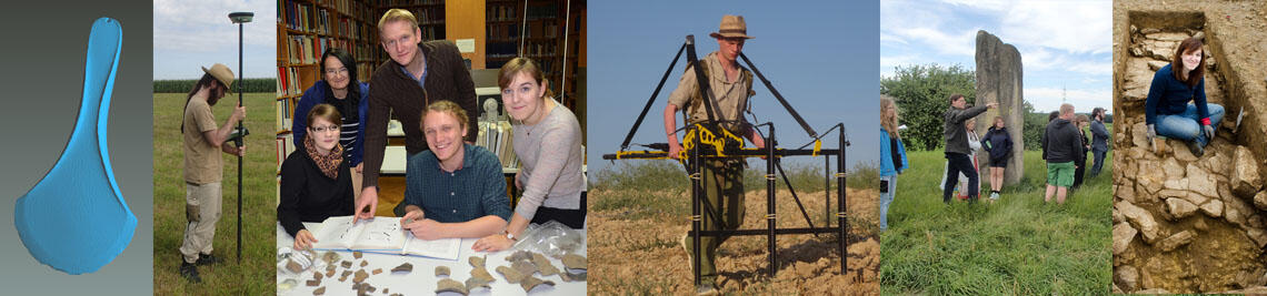
In spring and summer of 2007 archaeological prospections were undertaken at the site of Fidvár near Vráble in a Slovakian-German cooperative project. The field work included topographical mapping, intensive grid survey, drilling, as well as geomagnetic and geoelectric field measuring. Cooperative partners in the project were the Archaeological Institute of the Slovakian Academy of Sciences at Nitra (Jozef Bátora), and further the Professur für Ur- und Frühgeschichtliche Archäologie of the University of Bamberg (Frank Falkenstein), the Römisch-Germanische Kommission at Frankfurt (Knut Rassmann) as well as the Geographical Institute of the University of Heidelberg (Bernhard Eitel).
.")
Topographical mapping
During the campaign of spring 2007 the Römisch-Germanische Kommission by means of differential GPS generated a new topographical mapping of the entire settlement area, covering a surface of c. 15 ha. (fig. 6). The detail of the map shows the settlement mound of c. 2,5 ha. rising over a natural ridge of the terrain on the edge between the high river bank and the flood plain. The low mound is crossed by a horseshoe-shaped ditch, however the outer ditch at the foot of the mound is not revealed by the relief. The measuring grid of 20 m mesh and oriented to the north is laid across the prospection area.
.")
Geomagnetic prospection
A geomagnetic prospection using a fluxgate gradiometer was undertaken by students of the Universities of Bamberg and Heidelberg (fig. 7). In this way the settlement area was prospected over an extent of 11 ha.
.")
The detail of the geomagnetic plan clearly shows the curvilinear enclosing ditches running parallel to each other in this sector of the mound (fig. 8). In the area of and beyond the mound geomagnetic anomalies indicate the foundations of rectangular structures which form groups of houses and rows of buildings. Thus, significant details as to the layout of the Bronze Age settlement are obtained.
.")
Geoelectric prospection
During the geoelectric prospection that was carried out by the Geographical Institute of the University of Heidelberg altogether eight transsects were laid across the settlement mound and far into the adjacent fields (fig. 9). In this way, electric soil profiles were generated which reach down to c. 7 m depth and provide details of the sequence of sediment layers.
In Fig. 10 is illustrated a characteristic cross section of the settlement mound. The layers rendered in green and blue in the lower half of the transsect represent natural sediments dating to the Ice Age. Above these, the layers marked red to yellow indicate the cultural layer deposits of the Bronze Age of 2-3 m depth. The top of the mound and the ditch cutting into the horizontal layers in the central part are clearly discernible. To the east the section is delimited by the edge of the outer enclosing ditch at which the settlement layers end.
.")
On the cultivated surface of the mound and at the boundary ridge were found great amounts of sharp-edged boulders. Apparently, many tons of rock in the shape of fragments of parent material were transported from the mountains to the settlement mound by the inhabitants. Unexpected evidence of how the vast quantities of stones carried to the spot were used comes from a second geoelectric high-resolution profile (fig. 11). Below the present-day field surface and the ploughing zone rendered in green colour there extends an occupation layer about 1 m thick which contains vertical structures that are more or less clearly interconnected by socket-like bases. This evidence points to the existence, in the latest settlement phase of the Bronze Age, of foundations of houses built of dry-stone walls and with adjoining occupation surfaces.
..")
.")
Drilling
Test drillings using a hand drill have provided additional evidence as to the depth of the accumulated layer deposits of the mound and the dimensions of the system of enclosures. Thus it could be ascertained by a drilling sample from the outer ditch that this reaches a depth of 4 m, measured from the present-day surface (fig. 12). As a result of drilling at various points of the mound, the thickness of the accumulated layer deposits is 2-3 m in the centre of the settlement, and in the stretch between the two ditches the occupation layers decrease to 1-2 m thickness.
.")
Intensive grid survey
An intensive grid survey was conducted by members of the University of Bamberg and of the Archaeological Institute at Nitra. With this type of survey, the visible finds on the surface are gathered in total by using a system of grid squares with the edge length of the squares ranging between 5 to 20 m (fig. 13). In this way, about 2 t. of archaeological find materials were retrieved in a survey area of 12 ha. – comprising mainly pottery, but also fired clay, animal bones, grinding stones, as well as other artefacts of pottery, stone, antler and metal. In summer of 2007 the washing, counting, weighing and processing of the finds in a database was accomplished by Slovakian and German students.
.")
The tentative analysis of the statistical data collected in the intensive grid survey allows, e.g., to map the amounts of pottery finds by weight and to illustrate the distribution on the ground by laying isometric surfaces of the mapping over the overall geomagnetic plan (fig. 14). The diffusion of household pottery is particularly conclusive in that it indicates the location, extent and category of a settlement entity. The mapping of the pottery density laid over the geomagnetic plan in fig. 14 visualizes the original size of the Early Bronze Age settlement and the layout of the building structures. Thus, a series of settlement entities can be identified which are grouped as corona around the outer ditch in the forefield of the settlement mound proper. The size of the entire settlement area thus came up to about 15 ha. As the find scatter of datable pottery indicates, the settlement at Fidvár reached its greatest extent during its middle phase when the occupation was characterized by the Únětice culture.
.")
In the settlement area were found typical remains of metal working, like anvils, casting spoons, tuyères, a fragment of a mould, and a small hoard of bronze ornaments. From the frequency and wide distribution of such remains of production in the built-up area it can be concluded that the inhabitants of the settlement at Fidvár were intensely occupied with the processing and working of metals.
.")
Reconstructing the settlement organization
On the basis of the results from the geomagnetic prospection and the evidence of the surface finds, a reconstruction of the building plan of the Early Bronze Age settlement has been attempted (fig. 16). In detail the reconstruction remains, however, hypothetical as long as no excavation results are available. In its entirety, the settlement area extends over a stretch of more than 500 m length along the bank of the Žitava and over 300 m into the river terrace. The buildings appear to be concentrically oriented towards the oldest nucleus of the settlement on the multilayered mound. Possibly, the traditional centre of the mound was considered as locus of reference warranting the identity of the settlement community. Outside and within the enclosing ditches appear to have existed small compact blocks of buildings, with the groups of houses being arranged along a rectangular system of alleys. From the outside the settlement was probably accessible via a radial network of broad roads, which again was filled in a more or less rectangular mode by parallel streets and alleys.
Résumé
Vráble-Fidvár is a settlement complex of hitherto unexpected dimensions. The base of subsistence lay in the fertility of the surrounding loess plains, however the exploitation of the close-by gold and tin deposits constituted the real cause for the establishment and economic prosperity of the centre. The widely scattered remains of production point to intensive and decentralized metallurgical activities which took place in an extended area of the settlement. A further notable feature, as apparent by the geoelectric prospection, is the phase of elaborate stone constructions which likely characterizes the latest settlement at the site and is without parallel in the region. The ceramic finds prove that the inhabitants of the settlement were of different cultural origin. Namely, the bearers of the central European Únětice culture presumably arrived on the fringes of the Erzgebirge from the west, whereas the settlers related to the Hatvan culture originally came from the river basin of the Tisza. The merging of alien and indigenous population groups led to the formation of the Mad’arovce culture finally inhabiting the enclosed site. For reasons yet unknown the settlement at Fidvár, like most settlements of the same period in the Carpathian Basin, was abandoned by about the middle of the 2nd millennium B.C., and the site was not reoccupied in later times.
The results of the archaeological investigations undertaken so far are of a character spectacular to prehistoric research in Slovakia, and a range of new questions are raised thereby which shall duly be clarified in further field campaigns in the coming years:
- How were the industry and society of the settlement organized?
- How did the process of immigration and acculturation of the inhabitants take place?
- What were the exchange relations with nearby and more distant cultural regions?
- What technologies of metal industry were in use in the settlement?
- Where are the cemeteries of the settlement located?
- How were the stone buildings in the central settlement area constructed?
- What was the chronological range and course of development of the settlement phases and the system of enclosures?
Bátora, Eitel, Falkenstein, Rassmann
Bibliography:
Bakos, F., Chovan, M. (Hrsg.), Zlato na Slovensku. Sprievodca zlatou históriou, t'ažbou a náleziskami na našom územi (Gold in Slovakia) (2004).
Bartík, J., Die Metallgiesserei der Mad'arovce-Kultur. In: J. Bátora, J. Peška (Hrsg.), Aktuelle Probleme der Erforschung der Frühbronzezeit in Böhmen und in der Slowakei (1999) 183-193.
Kuzma, I., Blazová, E., Bartik, M., Rajtar, J., Letecka prospekcia na Slovensku / Luftbilprospektion in der Slowakei. Arch. výskumy a nálezy na Slovensku v roku 2000 (2001) 112-138.
Kuzma, I., Letecka prospekcia v Nitrianskom kraji. In: M. Ruttkay (Hrsg.), Davne dejiny Nitry a
okolia vo svetle najnovsich archeologickych nalezov (2005) 13-20.
Marková, K., Befestigte Siedlungen der älteren Bronzezeit im Süden der Mittelslowakei. In: A. Lippert, M. Schultz, St. Shennan, M. Teschler-Nicola (Hrsg.), Mensch und Umwelt während des Neolithikums und der Frühbronzezeit in Mitteleuropa (2001) 149-152.
Schalk, E., Die Entwicklung der prähistorischen Metallurgie im nördlichen Karpatenbecken. Eine typologische und metallanalytische Untersuchung (1998).
Točik, A., Opevnené sídlisko zo staršej doby bronzovey vo Vrábl´och. Slovenská Archaeológia 34, 1986, 463-476.
Točik, A., Žebrak, P., Ausgrabungen in Špania Dolina-Piesky. In: Archäometaalurgie der Alten Welt (1989) 71-78.
Vladár, J., Romsauer, P., Zur Problematik der Aunjetitzer Kulturen in der Slowakei. In: J. Bátora, J. Peška (Hrsg.), Aktuelle Probleme der Erforschung der Frühbronzezeit in Böhmen und in der Slowakei (1999) 127-136.
Staff:
Prof. Dr. Jozef Bátora, Uni Bratislava
Mihaela Durisova, Uni Trnava
Prof. Dr. Bernhard Eitel, Uni Heidelberg
Prof. Dr. Frank Falkenstein
Linda Fiserova, Uni Bratislava
Sven Glodniok, Uni Heidelberg
Dr. Stefan Hecht, Uni Heidelberg
Frantisek Hribal, Uni Trnava
Laura Kriete, Uni Bamberg
Nils Ostermeier, Uni Bamberg
Jan Peterek, Uni Bamberg
Dr. Knut Rassmann, Röm.-Germ. Kommission
Dipl.-Geologe Gerd Schukraft, Uni Heidelberg
Dr. Timo Seregély, Uni Bamberg
Peter Toth, Uni Brno
Tomas Zachar, Uni Brno
Petra Ziginova, Uni Bratislava
Cooperative Partners:
Prof. Dr. Jozef Bátora
Archäologisches Institut der Slowakischen Akademie der Wissenschaften
Dr. Knut Rassmann
Römisch-Germanische Kommission des Deutschen Archäologischen Instituts
Prof. Dr. Bernhard Eitel
Geographisches Institut
Ruprecht-Karls-Universität Heidelberg
Contact:
Prof. Dr. Frank Falkenstein
Lehrstuhl für Vor- und Frühgeschichtliche Archäologie
Institut für Altertumswissenschaften
Julius-Maximilians-Universität Würzburg
Residenzplatz 2, Tor A
D-97070 Würzburg
Prof. Dr. Frank Falkenstein